Question 862Navigation General
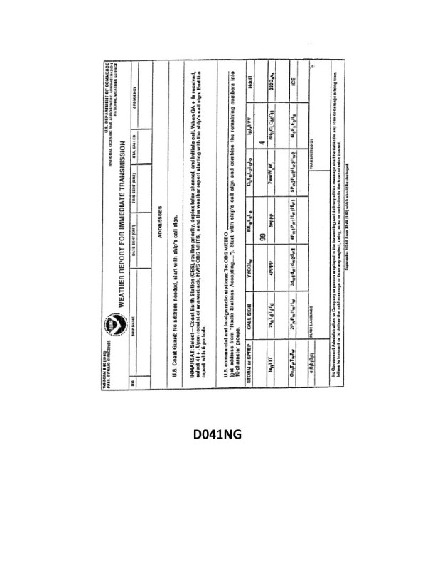
70% to passYour vessel is participating in the Voluntary Observing Ship Program, you are preparing WS Form B-80 as seen in illustration D041NG below. Your position is LAT 64°42'N, LONG 02°28'W. How would this be encoded?
A
9064N, 9025W
B
0647N, 00025
C
90647, 90024
D
99647, 70025
AI Explanation
The correct answer is D) 99647, 70025. The latitude of 64°42'N is encoded as 99647, with the first two digits representing the degrees (99 for 99 degrees) and the last three digits representing the minutes (647 for 42 minutes). The longitude of 02°28'W is encoded as 70025, with the first two digits representing the degrees (70 for 70 degrees) and the last three digits representing the minutes (025 for 28 minutes). The other options are incorrect because they do not accurately represent the latitude and longitude in the format required for the WS Form B-80 used in the Voluntary Observing Ship Program.
Related Questions
Q1520:A facility used for the discharge of a cargo of a particular hazard, such as chl...
Q1024:A line on a weather chart connecting places which have the same barometric pres...
Q1976:When the moon is new or full, which type of tides occur?
Q1159:Which Beaufort force indicates a wind speed of 65 knots?
Q1550:In the celestial equator system of coordinates what is NOT equivalent to the lon...
Ready to test your knowledge?
Take a Navigation General Practice ExamOfficial Resources
Want to practice with timed exams?
Download Coast Guard Exams for the full exam experience.
App Store